Our website and our own links are in English. Some external links are not translated, and we’re sorry that we can’t help with their content. We recommend using a browser with built-in translation support.
Hikes with overnight stays
(22 km to 87 km, with different levels of difficulty)
We are lucky to have many different hiking trails in our region. There are many routes to walk, but to get there by bus you will often need to stay overnight in the forest, sometimes for one or two nights. It is a lovely feeling to wake up in the forest, take a morning swim and have breakfast in the quiet. We have selected different stages of longer hikes. They vary in difficulty, and you should check in advance that the trail is accessible.
There are links to Bergslagsleden trails at the bottom of the page where you can read more about each route. The links go to both Naturkartan and the trails’ own websites.
Silverleden
Silverleden is a 65 km long hiking trail, starting and finishing at Hurtigtorpet in Hällefors. It passes through an area where silver mining was extensive in the 17th century. Parts of the trail are quite steep and rugged, with a landscape similar to northern Sweden, and there are many lakes and streams along the way. There are places along the trail where you can refill water. A map is available to buy at Hällefors Hostel and Canoe Centre, as well as at OK Q8 in Hällefors.
More information:
- Bus stop:
- Hällefors resecentrum, route 400. It is about 1.7 km from the bus stop to the course.
- Schillingvägen, route 402 (weekdays only), 420 och 490. It is about 1.1 km from the bus stop to the course.
- Silverleden - Friluftsfrämjandet
- Karta Silverleden
Postleden 1-4 Hällefors to Kopparberg
Postleden offers a calm walk through forest, wetlands and old woodland, with clear traces of old cottages, charcoal pits and early mining. The middle sections feel very calm and undisturbed, while the landscape becomes more shaped by history as the trail gets closer to Kopparberg.
The route is about 61 km long and is overall of medium to challenging difficulty, with the most demanding sections in Stages 2 and 3.
More information:
- Bus stop:
- Hällefors resecentrum, route 400. It is about 1.7 km from the bus stop to the course.
- Schillingvägen, route 402 (weekdays only), 420 och 490. It is about 1.1 km from the bus stop to the course.
- Kopparbergs station, route 308 (weekdays only), 360 (weekdays only) and train. It is about 1.7 km from the bus.
- Postleden stage 1-4 - Bergslagsleden
- Postleden stage 1 - Naturkartan
- Postleden stage - Naturkartan
- Postleden stage 3 - Naturkartan
- Postleden stage 4 - Naturkartan
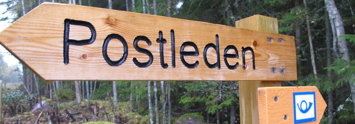
Photo: Bergslagsleden
Different stages of Bergslagsleden
To follow Bergslagsleden, look for the orange markers in the forest. The trail is divided into three levels of difficulty: green (easy), blue (medium) and red (challenging).
Stage 14: Svartå to Ramundeboda
Stage 14 runs from Svartå to Ramundeboda. It takes you through parkland, forests and large wetlands. One highlight you should not miss is the impressive boulder fields at Ekåsabränningen, as well as the untouched wetland, Rankemossen. This is one of the few completely undisturbed wetlands in Närke and stretches as far as the eye can see. The stage is 22 km long, the shortest on this page, and is suitable for either a longer day trip or a shorter two-day hike.
Difficulty level: Stage 14-blue
More information:
- Bus stop:
- Bruksgatan, Svartå, route 593. (Bus 593 only runs on weekdays. You can change to this bus at Laxå station or Karlskoga bus station.) It is 400 m from the bus stop to the trail.
- Bodane, Ramundeboda, route 761. (Bus 761 only runs on weekdays. You can change to this bus at Laxå station.) It is 400 m from the bus stop to the trail.
Photo: Bergslagsleden
Stages 6–7: Bergslagsleden bus stop to Mogetorp
(You do not walk all of Stage 6)
The hike starts on Stage 6 at the Bergslagsleden bus stop, and you then walk towards Pershyttan (about half of Stage 6). The trail passes old industrial areas before reaching the well-preserved historic mining and ironworks area in Pershyttan, with remains of mines, water channels and old mining farms. The hike then continues towards Mogetorp through forest, mixed with lakes and more open sections, where traces of early mining can be seen along the way. This combined route is about 22 km long and is suitable for a shorter multi-day hike or a longer day hike.
Difficulty level: Stage 6 blue and Stage 7 blue
More information:
Photo: Bergslagsleden
Stages 10–11: Ånnaboda to Lekhyttan
By combining Stages 10 and 11 of Bergslagsleden, you get a hike of about 23 km, starting in the outdoor recreation area in Ånnaboda and continuing towards the village and cultural landscapes around Lekhyttan. This stretch offers a wide variety over a relatively short distance, from easy forest paths and lakes to more open sections and hilly terrain on the edges of the Kilsbergen hills. The hike passes through classic Bergslagen scenery with clear traces of old industrial areas and forestry. It also passes several places suitable for overnight stays, making it well suited for a shorter multi-day hike or a longer day hike.
Difficulty level: Stage 10-blue and Stage 11-red
More information:
- Bus stop:
- Ånnaboda friluftsområde, route 890 (Sommarbussen)
- Lekhyttan, route 500
Photo: Bergslagsleden
Stages 8–9: Mogetorp to Ånnaboda
You can combine Stages 8 and 9 of Bergslagsleden for a longer hike between Mogetorp and Ånnaboda. The route goes through the varied landscape of the Kilsbergen hills, with hilly forest, wetlands, higher ground and lakes that offer changing scenery. Along the way, you pass both peaceful forest areas and more open stretches with views of the surroundings. This combined route is about 24 km long and is well suited for a hike with an overnight stay along the way or as a long day hike.
Difficulty level: Stage 8-red and Stage 9-blue
More information:
- Bus stop:
- Mogetorp, route 300, 401 and 490
- Ånnaboda friluftsområde, route 890 (Sommarbussen)
Photo: Bergslagsleden
Stages 7–9: Pershyttan to Ånnaboda
The hike along Stages 7–9 of Bergslagsleden starts in the historic mining community of Pershyttan and continues through the forests of the Kilsbergen hills towards Ånnaboda. This route is about 39 km long and offers clear changes in terrain, with both more demanding, hilly sections and calmer stretches where the landscape opens up. The trail changes in scenery and character as you walk along it.
Difficulty level: Stage 7-blue, Stage 8-red and Stage 9-blue
More information:
- Bus stop:
- Pershyttevägen route 402 (weekdays only), 403 (weekdays only) and 490. It is about 1.2 km from the bus stop to the trail.
- Ånnaboda friluftsområde, route 890 (Sommarbussen)
Photo: Bergslagsleden
Stages 12–13: Lekhyttan to Svartå
Stages 12–13 of Bergslagsleden together form a hike of about 42 km between Lekhyttan and Svartå. The route goes through both the forests of the Kilsbergen hills and the Bergslagen area, and offers clear variation in the landscape, with lakes, protected nature areas and traces of old mining and industrial sites along the way. Along the route, nature and history alternate.
Difficulty level: Stage 12-red and Stage 13-blue
More information:
- Bus stop:
- Lekhyttan, route 500
- Bruksgatan, Svartå, route 593. (Bus 593 only runs on weekdays. You can change to this bus at Laxå station or Karlskoga bus station.) It is 400 m from the bus stop to the trail.
Photo: Bergslagsleden
Stages 6–9: Bergslagsleden bus stop to Ånnaboda
(You do not walk all of Stage 6)
The hike starts on Stage 6 at the Bergslagsleden bus stop and then continues towards Pershyttan (about half of Stage 6). This combined route is about 46 km and passes through Pershyttan and Mogetorp. You follow several connected sections of Bergslagsleden. You walk through the well-preserved historic mining and ironworks area in Pershyttan, with mines, water channels and old mining farms. The hike then continues through forest and lakes towards Mogetorp, and further on through more hilly terrain to Ånnaboda, where outdoor areas and more open landscapes mark the end. The route shows clear changes in landscape and character along the way.
Difficulty level: Stage 6-blue, Stage 7-blue, Stage 8-red and Stage 9-blue
More information:
- Bus stop:
- Bergslagsleden (Start the trail at the bus stop), route 401, 406, 420 and 490.
- Ånnaboda friluftsområde, route 890 (Sommarbussen)
Photo: Bergslagsleden
Stages 8–11: Mogetorp to Lekhyttan
By combining Stages 8–11 of Bergslagsleden, you get a continuous hike of about 47 km from Mogetorp to Lekhyttan. The route takes you through the Kilsbergen hills, from more demanding and hilly sections in the middle stages to slightly easier stretches with lakes and forest paths towards the end. The hike offers a wide variety along the trail, with changing terrain, peaceful forest areas and more open sections where the landscape gradually changes. The route passes several places with good opportunities for rest along the way.
Difficulty level: Stage 8-red, Stage 9-blue, Stage 10-blue and Stage 11-red
More information:
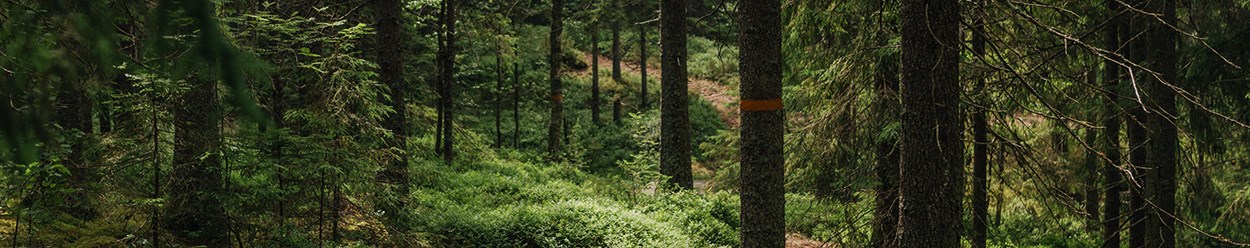
Photo: Bergslagsleden
Stages 7–11: Pershyttan to Lekhyttan
This hiking trail is one of STF’s selected signature trails in Sweden.
The hike between Pershyttan and Lekhyttan is about 61 km and takes you through some of the most varied environments along Bergslagsleden.
From the historic mining and ironworks landscape of Pershyttan, the trail continues into forest and higher ground, where the path is sometimes hilly and more demanding. Further on, the hike passes peaceful forest areas, lakes and more open parts in the Kilsbergen hills before reaching the more cultural landscapes around Ånnaboda and continuing towards Lekhyttan. The route shows clear changes in nature and character along the way.
Difficulty level: Stage 7-blue, Stage 8-red, Stage 9-blue, Stage 10-blue and Stage 11-red
More information:
- Bus stop:
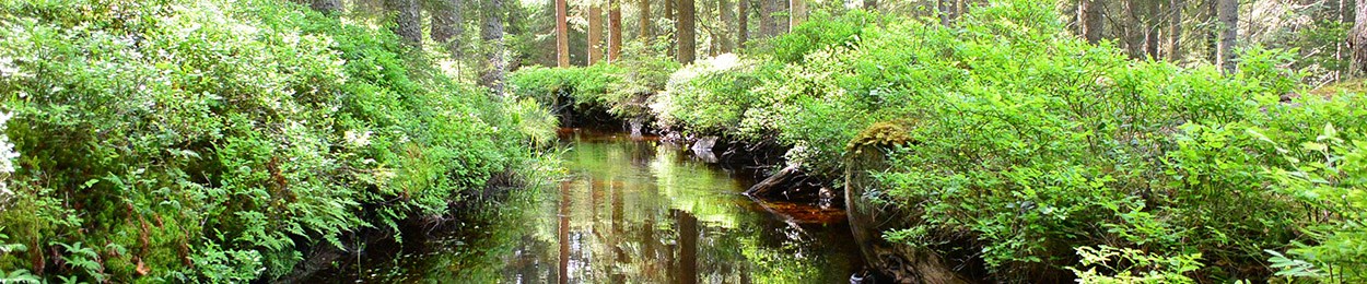
Photo: Bergslagsleden
Stages 12–14: Lekhyttan to Ramundeboda
The hike between Lekhyttan and Ramundeboda is about 64 km long and takes you from the forests and higher ground of the Kilsbergen hills into the more open and cultural landscapes of the Bergslagen area. Along the route, peaceful forest areas and lakes are mixed with areas that show clear traces of old mining and industrial history. Towards the end, the landscape gradually changes as the trail approaches Ramundeboda, where cultural landscapes and historic sites give the hike a new character. The route offers a wide variety along the way.
Difficulty level: Stage 12-red, Stage 13-blue and Stage 14-blue
More information:
- Bus stop:
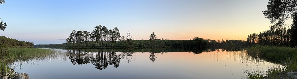
Photo: Bergslagsleden
Stages 10–13: Ånnaboda to Svartå
The route between Ånnaboda and Svartå is about 65 km long and takes you through both the Kilsbergen hills and the forests of the Bergslagen area. Along the trail, hilly forest terrain and lakes are mixed with more cultural landscapes, where traces of old mining and industrial sites shape the surroundings. The hike shows clear changes in nature and character as the route continues south towards Svartå.
Difficulty level: Stage 10-blue, Stage 11-red, Stage 12-red and Stage 13-blue
More information:
- Bus stop:
- Ånnaboda friluftsområde, route 890 (Sommarbussen)
- Bruksgatan, Svartå, route 593. (Bus 593 only runs on weekdays. You can change to this bus at Laxå station or Karlskoga bus station.) It is 400 m from the bus stop to the trail.
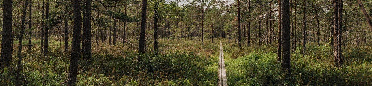
Photo: Bergslagsleden
Stages 2–6: Kopparberg to Bergslagsleden bus stop
(You do not walk all of Stage 2 or Stage 6)
The hike starts in Kopparberg and includes parts of Stage 2, all of Stages 3–5, and parts of Stage 6 of Bergslagsleden. Together, they form a route of about 77 km through northern Bergslagen. The trail begins in Kopparberg and continues through areas shaped by old mining and industrial history, with remains, water channels and small industrial villages along the way. During the hike, you pass lakes, wetlands and hilly forest areas before reaching Hammarby, where you find industrial sites and the Järleån river. From there, you walk about half of Stage 6 to the Bergslagsleden bus stop.
Difficulty level: Stage 2-blue, Stage 3-red, Stage 4-blue, Stage 5-blue and Stage 6-blue
More information:
- Bus stop:
- Kopparbergs station, route 308 (weekdays only), 360 (weekdays only) and train.
- Bergslagsleden (Finish the trail at the bus stop), route 401, 406, 420 and 490.
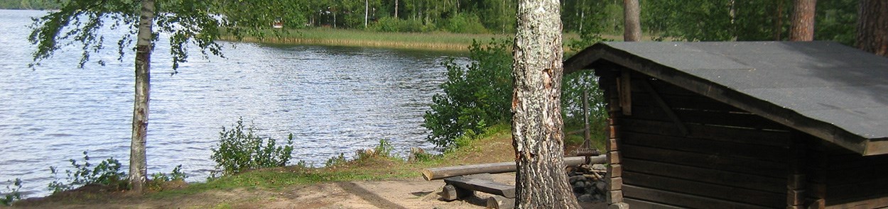
Photo: Bergslagsleden
Stages 2–6: Kopparberg to Pershyttan
The route between Kopparberg and Pershyttan includes parts of Stage 2 and Stages 3–6, forming a hike of about 83 km through the Bergslagen area. The hike passes several old industrial villages and mining remains, with mine shafts, slag heaps and historic ironworks sites along the trail. On the way, the path leads past small lakes, wetlands and higher ground with views over the forest landscape, before ending in the well-preserved historic mining and ironworks area in Pershyttan, with an old iron furnace, water channels and old mining farms.
Difficulty level: Stage 2-blue, Stage 3-red, Stage 4-blue, Stage 5-blue and Stage 6-blue
More information:
- Bus stop:
- Kopparbergs station, route 308 (weekdays only), 360 (weekdays only) and train.
- Pershyttevägen route 402 (weekdays only), 403 (weekdays only) and 490. It is about 1.2 km from the bus stop to the trail.
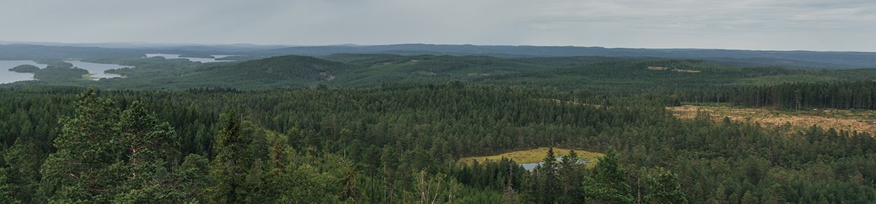
Photo: Bergslagsleden
Stages 10–14: Ånnaboda to Ramundeboda
The hike between Ånnaboda and Ramundeboda is about 86 km long and passes through several clearly different parts of Bergslagsleden. From the outdoor areas around Ånnaboda, the trail continues through forest and lakes towards Lekhyttan, where old villages and mining farms shape the landscape. Further south, the trail passes areas with mining remains, old industrial traces and peaceful lakes before reaching Svartå with its industrial history. Towards the end, the character changes again as the trail approaches Ramundeboda, where monastery ruins, cultural sites and more open landscapes mark the end of the route.
Difficulty level: Stage 10-blue, Stage 11-red, Stage 12-red, Stage 13-blue and Stage 14-blue
More information:
- Bus stop:
- Ånnaboda friluftsområde, route 890 (Sommarbussen)
- Bodane, Ramundeboda, route 761. (Bus 761 only runs on weekdays. You can change to this bus at Laxå station.) It is 400 m from the bus stop to the trail.
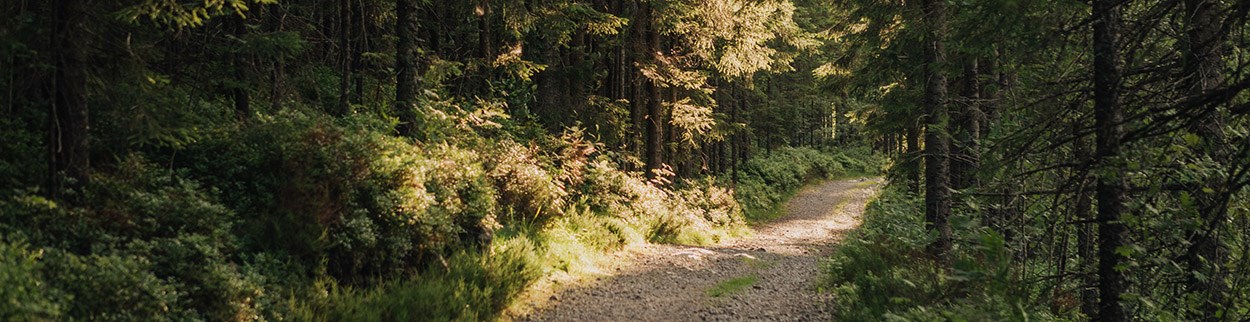
Photo: Bergslagsleden
Links
- Gillersklack - Stjärnfors, Bergslagsleden Stage 2
- Gillersklack - Stjärnfors, Bergslagsleden Stage 2 - Naturkartan
- Stjärnfors - Nyberget, Bergslagsleden Stage 3
- Stjärnfors - Nyberget, Bergslagsleden Stage 3 - Naturkartan
- Nyberget - Uskavi, Bergslagsleden Stage 4
- Nyberget - Uskavi, Bergslagsleden Stage 4 - Naturkartan
- Uskavi - Hammarby, Bergslagsleden Stage 5
- Uskavi - Hammarby, Bergslagsleden Stage 5 - Naturkartan
- Hammarby - Pershyttan, Bergslagsleden Stage 6
- Hammarby - Pershyttan, Bergslagsleden Stage 6 - Naturkartan
- Pershyttan - Mogetorp, Bergslagsleden Stage 7
- Pershyttan - Mogetorp, Bergslagsleden Stage 7 - Naturkartan
- Mogetorp - Blankhult, Bergslagsleden Stage 8
- Mogetorp - Blankhult, Bergslagsleden Stage 8 - Naturkartan
- Blankhult - Ånnaboda, Bergslagsleden Stage 9
- Blankhult - Ånnaboda, Bergslagsleden Stage 9 - Naturkartan
- Ånnaboda - Suttarboda, Bergslagsleden Stage 10
- Ånnaboda - Suttarboda, Bergslagsleden Stage 10 - Naturkartan
- Suttarboda - Lekhyttan, Bergslagsleden Stage 11
- Suttarboda - Lekhyttan, Bergslagsleden Stage 11 - Naturkartan
- Lekhyttan - Sixtorp, Bergslagsleden Stage 12
- Lekhyttan - Sixtorp, Bergslagsleden Stage 12 - Naturkartan
- Sixtorp - Svartå, Bergslagsleden Stage 13
- Sixtorp - Svartå, Bergslagsleden Stage 13 - Naturkartan
- Svartå - Ramundeboda, Bergslagsleden Stage 14
- Svartå - Ramundeboda, Bergslagsleden Stage 14 och Munkastigen Stage 3 - Naturkartan